
Heavy Rain, Large Hail Reported In Parts Of SE Minnesota

Rochester, MN (KROC AM News) - Storm cells developed in the Faribault/Owatonna area around 7:00 am Wednesday and slowly began moving east/northeast.
They also began growing in size and intensity and were soon covering an area from Faribault to Rochester and north to Cannon Falls and over to the Mississippi River.
And they were soon producing brief periods of heavy rain and large hail.
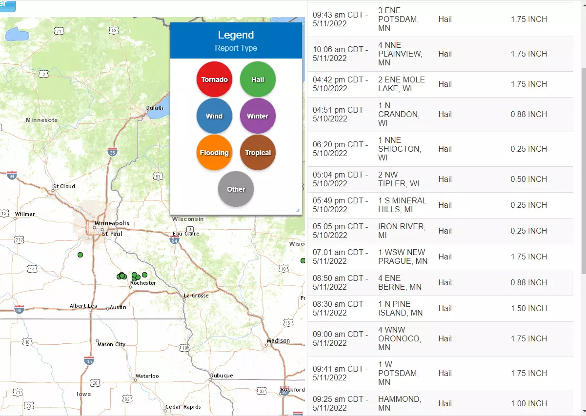
The National Weather Service issued a series of storm warnings and began receiving numerous reports of hail, some as large as tennis balls in the Plainview area.
More than 3 inches of rain was reported in the Waseca and Pine Island areas.
A flood warning was issued for the Middle Fork Zumbro River at Pine Island as another 1 - 2 inches of rain could fall. The river is expected to reach minor flood stage by early afternoon.
(CLICK TO ENLARGE)
At 9:30 am, another line of storm cells began developing between Albert Lea and Faribault. The cells began growing in size as they moved east/northeast across southeast Minnesota.
Jennifer Carnahan threatened
INCREDIBLE: See Inside George Strait's Spectacular Texas Mansion
More From KQCL Power 96


![Bogen Belts First Home Run; Huskies Roll to Victory [May 10 Scores]](http://townsquare.media/site/687/files/2022/05/attachment-Samantha-and-Kendra-Bogen.jpg?w=980&q=75)