National Weather Service Duluth Shares Photos From Ship Facing 9-10 Foot Waves
To say the weather across the Northland was nasty today would be an understatement. Strong winds and, at times, even stronger winds dominated our day.
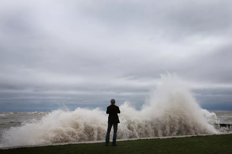
While conditions were stormy on shore, imagine being on Lake Superior facing the conditions we had Thursday afternoon. There were those who were out there, including the crew aboard the Joyce L. VanEnkevort Galen Witham. Not only where they out there, but they shared their experience with the National Weather Service in Duluth.
Late in afternoon, the National Weather service shared the photos, which were provided by the ship's second mate, on their Facebook page.
Thanks to 2nd mate of the Joyce L. VanEnkevort Galen Witham for sending in these amazing photos along the North Shore of 9-10 ft waves while heading towards Grand Portage.

Take a look at the conditions the crew were faced with.
Moving forward, weather in the Twin Ports area will have a wintry feel, but it will be worse outside of our area. According to meteorologist Justin Liles, with our media partners at WDIO-TV, here is our extended forecast:
- THURSDAY NIGHT
Rain, freezing rain and snow all likely tonight, Cloudy, with a low around 27. Breezy, with an east wind 15 to 20 mph becoming southwest 10 to 15 mph in the evening. Winds could gust as high as 30 mph. - VETERANS DAY
A chance of snow shower early. Cloudy, with a temperature rising to near 31 by 10am, then falling to around 26 during the remainder of the day. Blustery, with a west wind 10 to 15 mph becoming north in the afternoon. Winds could gust as high as 25 mph. - FRIDAY NIGHT
A 20 percent chance of snow showers before 7pm. Mostly cloudy, with a low around 20. Blustery, with a north wind 10 to 15 mph, with gusts as high as 25 mph. - SATURDAY
Partly sunny, with a high near 28. Blustery, with a north wind 10 to 15 mph, with gusts as high as 25 mph. - SUNDAY
Partly sunny, with a high near 28. North wind around 5 mph becoming northeast in the afternoon.
LOOK: The most expensive weather and climate disasters in recent decades
25 costliest hurricanes of all time
More From KQCL Power 96