Another Hot Day, Storms Possible Later
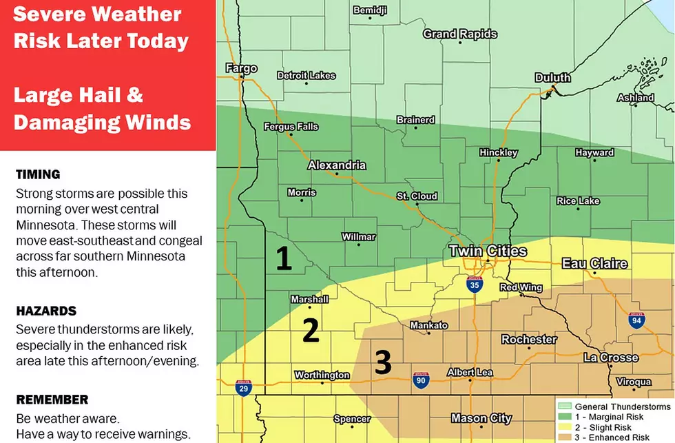
UNDATED -- The risk of severe thunderstorms has increased later Tuesday as SPC has highlighted an enhanced area of severe weather potential.
A few morning and early afternoon thunderstorms will be possible as across western Minnesota. These storms are forecast to move east across southern Minnesota Tuesday afternoon.
The greatest threat of severe thunderstorms will occur by mid-late afternoon from Mankato, eastward to Owatonna and Albert Lea.
SPC will be updating these outlooks this morning and again this afternoon. Please be aware of the latest forecast.
National Weather Service
Tuesday will be similar to Monday with heat indices in the mid to upper 90s along the Iowa border.
If working outside, please drink plenty of water. Stay Cool!

Enter your number to get our free mobile app
New Outdoor Seating for St. Cloud Area Bars and Restaurants
More From KQCL Power 96
![MN National Guard, Civilians Clean Up MSP Rubble Together [WATCH]](http://townsquare.media/site/68/files/2020/06/MN-National-Guard-2.jpg?w=980&q=75)